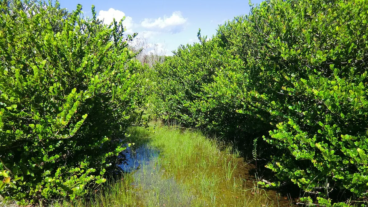
Everglades Nationalpark in Florida- Along Shark Valley Road (15771655850) — Everglades National Park
Photo: Reinhard Link from Germany · CC BY-SA 2.0 · Wikimedia Commons
Free travel itinerary template · 2 days

Everglades National Park 2-Day Itinerary

Royal Palm and the main park road; Shark Valley loop by booked tram. Royal Palm and Shark Valley are separate entry districts connected by a substantial drive outside the park. Stage near the correct entrance before each day; do not assume an internal through-road.


Curated from official tourism guides · Researched 2026-11-10Sources & notes

The stops are drawn from the guides below; daily order, times and durations are our suggested adaptation. Available map pins are approximate, not provider-verified; missing coordinates remain unset. Prices are left unknown; check tickets, opening hours and transport before booking.

  • Access / base: Homestead for Royal Palm; book a separate Shark Valley day. Gateway travel and flights are outside the park sightseeing days.
  • Season: Dry season is generally more comfortable; lightning, heat and high water change access.
  • Royal Palm and Shark Valley are separate entry districts connected by a substantial drive outside the park. Stage near the correct entrance before each day; do not assume an internal through-road.

  • Check current NPS alerts, roads, reservations, permits, trail closures and transport at https://www.nps.gov/ever/index.htm and the linked park guides before choosing dates. A park pass does not include timed entry, a tour, ferry, flight, campsite or concession ticket.
  • The sequence is an editable planning suggestion, not a live timetable or turn-by-turn navigation. Visit blocks include time to explore and rest; traffic, queues, weather, accessibility and booked departures may require a shorter day. Bring an offline official map and arrange return transport.
  • Available approximate map pins are adapted from https://en.wikivoyage.org/wiki/Everglades_National_Park, revision 5424964, Wikivoyage contributors, CC BY-SA 4.0. Missing pins are left blank; confirm the real trailhead / landing with NPS or your operator.

Everglades National Park itinerary: 2 days at a glance

Every stop and suggested time, day by day

Review the original daily plan before editing below. Times and durations are suggested planning blocks; dining stops are not reservations. Your personal edits appear in the editor and downloads.

Day 1: Royal Palm and the main park road

  • Anhinga Trail · 90 min
  • Food, water and route transfer break · 60 min
  • Gumbo Limbo Trail · 60 min
  • Transfer to the next park stop · 30 min
  • Pa-hay-okee Overlook · 60 min
  • Transfer to the next park stop · 30 min
  • Mahogany Hammock Trail · 90 min

Day 2: Shark Valley loop by booked tram

  • Shark Valley Visitor Center · 60 min
  • Food, water and route transfer break · 60 min
  • Shark Valley tram loop and observation tower · 180 min
  • Transfer to the next park stop · 30 min
  • Bobcat Boardwalk · 60 min

Download this itinerary

Free with a free account
Customise right here: move, duplicate, add or delete days and activities, then download.
Day 1
  • 08:0090m
    Anhinga Trail, Everglades National Park, FloridaMap

    Official park source: https://www.nps.gov/ever/planyourvisit/things2do.htm. Access reviewed 2026-11-10; recheck before travel. Coordinate source: https://en.wikipedia.org/wiki/Anhinga_Trail. Approximate map pin; confirm the actual trailhead and open route with the official park map.

  • 09:3060m
    Everglades National ParkMap

    Editable allowance, not a measured travel time or included service. Follow the described district sequence and verify current driving, shuttle or trail connections. Bring food where no services operate.

  • 10:3060m
    Gumbo Limbo Trail, Everglades National Park, FloridaMap

    Official park source: https://www.nps.gov/ever/index.htm. Access reviewed 2026-11-10; recheck before travel. Coordinate source: https://en.wikipedia.org/wiki/Everglades_National_Park. Approximate map pin; confirm the actual trailhead and open route with the official park map.

  • 11:3030m
    Everglades National ParkMap

    Editable allowance, not a measured travel time or included service. Follow the described district sequence and verify current driving, shuttle or trail connections. Bring food where no services operate.

  • 12:0060m
    Pa-hay-okee Overlook, Everglades National Park, FloridaMap

    Official park source: https://www.nps.gov/ever/index.htm. Access reviewed 2026-11-10; recheck before travel. No verified map pin is supplied. Use the official park map to locate the trailhead, viewpoint or operator-agreed landing.

  • 13:0030m
    Everglades National ParkMap

    Editable allowance, not a measured travel time or included service. Follow the described district sequence and verify current driving, shuttle or trail connections. Bring food where no services operate.

  • 13:3090m
    Mahogany Hammock Trail, Everglades National Park, FloridaMap

    Official park source: https://www.nps.gov/ever/index.htm. Access reviewed 2026-11-10; recheck before travel. No verified map pin is supplied. Use the official park map to locate the trailhead, viewpoint or operator-agreed landing.

Day 2
  • 08:0060m
    Shark Valley Visitor Center, Everglades National Park, FloridaMap

    Official park source: https://www.nps.gov/ever/index.htm. Access reviewed 2026-11-10; recheck before travel. Coordinate source: https://en.wikivoyage.org/wiki/Everglades_National_Park. Approximate map pin; confirm the actual trailhead and open route with the official park map.

  • 09:0060m
    Everglades National ParkMap

    Editable allowance, not a measured travel time or included service. Follow the described district sequence and verify current driving, shuttle or trail connections. Bring food where no services operate.

  • 10:00180m
    Shark Valley tram loop and observation tower, Everglades National Park, FloridaMap

    Reserve an operator departure when required; the full loop is long and exposed, so do not replace it with an unplanned afternoon walk. Official park source: https://www.nps.gov/ever/index.htm. Access reviewed 2026-11-10; recheck before travel. No verified map pin is supplied. Use the official park map to locate the trailhead, viewpoint or operator-agreed landing.

  • 13:0030m
    Everglades National ParkMap

    Editable allowance, not a measured travel time or included service. Follow the described district sequence and verify current driving, shuttle or trail connections. Bring food where no services operate.

  • 13:3060m
    Bobcat Boardwalk, Everglades National Park, FloridaMap

    Official park source: https://www.nps.gov/ever/index.htm. Access reviewed 2026-11-10; recheck before travel. No verified map pin is supplied. Use the official park map to locate the trailhead, viewpoint or operator-agreed landing.

Been to Everglades National Park? Share your experience

What was worth it, what you'd skip, where you ate. Your tips help the next traveller plan this trip.

Share your experience

Keep planning your trip

Similar routes and the tools to finish your plan.

140Compare all 140 United States itinerariesSee all routes 1 daysCarlsbad Caverns National Park 1-Day ItineraryCarlsbad Caverns National Park1 daysChannel Islands National Park 1-Day ItineraryChannel Islands National Park1 daysChiricahua National Park 1-Day ItineraryChiricahua National Park1 daysCongaree National Park 1-Day ItineraryCongaree National Park
More weekend itinerary templatesShort routes for a two or three day trip.Add this itinerary to your calendarEvery timed stop as an event in Google, Apple or Outlook Calendar.Download formats and instructionsPDF, Google Docs, Sheets, Excel and calendar, step by step.Build a realistic daily schedulePace each day with travel time, opening hours and breaks.

Frequently asked questions

Can I edit and download this itinerary?

Yes. It is free to edit any itinerary, start a blank one and download it as PDF, Google Docs, Google Sheets, Excel, CSV or a calendar file, with 20 free designs for PDFs and Google Docs. Pro ($5.99/month or $49.99/year (save 30%), or $9.99 once for a 30-day Trip Pass) unlocks every design for printable PDFs and Google Docs (100+) with unlimited downloads, an Excel planner with live formulas and charts, and a higher AI chat allowance.

Do I need to sign up to use this itinerary?

No sign-up is needed to browse, edit or use the AI chat. Downloading (PDF, Google Docs, Excel, Google Sheets, calendar, CSV or print) needs a free account (email link or Google, no credit card), which also keeps trips in My trips across devices; without one, trips are kept in your browser.

Are this itinerary's times and prices live?

No. Templates are drawn from official tourism boards and community travel guides and edited for pacing. Opening hours, prices and transport times are not live data: check them before you travel.

Does exporting to Google Docs or Google Sheets sync my changes?

No. Google Docs works through an editable .docx file in the same designs as the PDFs (20 free, the rest with Pro): upload it to Google Drive and open it with Google Docs. It also opens in Microsoft Word and Apple Pages. There is no live sync with Google. Google Sheets works by copy and paste: the itinerary is copied as a table that you paste into a new sheet. There is no live sync with Google.